Rattlesnake Canyon
Rattlesnake Canyon
Santa Barbara, California
3 miles
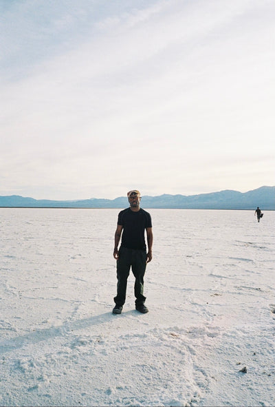
It’s a hot, cloudless Saturday out on the coast, and the wind refuses to rise as we leave the beach and head up into the mountains. There are very few places where one can transition from surf into switchback in minutes, and Santa Barbara is one of them. The peaks of the Santa Ynez jolt so suddenly out of the sea that they seem to risk toppling over, and the freeway does its best to squeeze by in the small corridor that’s left between the foothills and the breakers. The effect is hard to overstate: from the beach, one can see summits rising 4,000 feet, nearly overhead; from the peaks, one can see many miles out into the vast open ocean.
Barely fifteen minutes from the briny air of downtown, the entrance to Rattlesnake Canyon sits at the northern tip of Skofield Park, about a mile north of Route 192, tucked up into the foothills. Ray Skofield, a wealthy New York businessman, owned the entirety of the canyon in the early 20th century, until his son Hobart sold the upper 450 acres (the current park) to the state in 1970 for a modest $150,000, half of its actual value. Per his request, the land is now a designated wilderness. So of course, we tried it out.
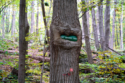
As the road curves around the park’s far end, it narrows into a quaint stone bridge, where the trail follows the creek away and out of sight. The trailhead is easy to spot, with a large sign that reads “Rattlesnake Canyon Wilderness Area,” and there’s relatively plentiful parking along both sides of the road, in the dust.


At first, the trail hugs the creek closely, crossing just below the sandstone bridge, which lends the scene a folksy, Western-vintage sort of look. Moving upstream, the cold water combines with the shade to make for a mercifully cooler atmosphere. It’s nice to see water out here at all, to be honest, given our state’s propensity for drought. That’s a large part of this certain trail’s charm: its relentlessness.


Not in bad ways, per se. But as in how the creek, as it follows the trail on its steady, slow climb, just keeps cascading, keeping pace with the hikers at every turn. It’s as if it insists on being beautiful. And it works.
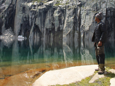
About half a mile after the bridge, the trail crosses again over the creek, and, if one is feeling adventurous, one can follow it straight up the canyon. This requires a lot of boulder hopping and slippery scrambles, so take care—but if you’re willing, you’ll encounter the crumbling remains of the old mortar dam, constructed in 1808, in replacement of the previous mud and brush dam built by hard Chumash labor, which supplied the Santa Barbara Mission. But if not, the trail continues on firm ground across the creek.


At this point, you might start to huff and puff a bit, as the route curves up and to the left, lifting out above the tree cover onto a high ridge overlooking the creek. The incline banks steeply, at times reaching nearly thirty degrees, and the sun is assaultingly hot, the temperature climbing into the low nineties. The footing is rocky, though not loose or slippery, and the views begin to grow increasingly impressive, the blue streak of the ocean rising up as if filling the canyon below us, and beyond it the shadowy humps of the Channel Islands standing like a wall before the open sea. It’s well worth it to take a quick breather here. Or two.


And then, as we’re about to trudge around another rocky corner, a voice calls out, stark, but amusingly restrained: “Hey-y-y there. Gotta snake.”
And oh, he does.
Now, I recognize how convenient it seems to have a rattlesnake appear when in Rattlesnake Canyon, but I promise, it did—and it was, indeed, awesome. See, I’ve never seen rattlesnakes out in the wild before (so humor me if this seems a bit dramatic), but its body is utterly wild. The sheer thickness of it strikes me first. In the middle of the trail, just beside a large rock it sits, half-unwound, as a man in flamingo pink shorts pokes the sand by its rattles with a limp alder stick. (Be advised: Do not do that.) Despite him, it’s slow to uncoil, and as it slithers silently into the shade I can see that it’s bigger around than my wrist, at least three feet long, and its head is blunt and heavy. The pattern of its scales is like some kind of Scottish tartan, and its rattles jut out much more stiffly than I would have thought, appearing almost as though they were stuck to its tail accidentally. With a few quick slithers that look as though they bend in time, it’s away and into the brush, leaving a faint crescent trail in the sand. Flamingo Shorts Man passes by with a nod, shaking his stick as if in victory, and we both carry on, feeling starstruck.

Wildlife in general is plentiful here, at least in comparison to the adjacent urban sprawl. Be aware that such encounters are not altogether uncommon, and mountain lions (as a sign by the entrance warns) have made occasional appearances.
Mercifully, the trail soon flattens out a bit, and the shade returns. Passing below the broad arms of some thick oaks, the creek meets with the path again, and over the course of the next few hundred meters, we’re treated to some of the most wonderful cascades in the Santa Barbara area. One after the other, the smooth drops and clear pools flash and gurgle with a charming expressiveness, inviting passers-by to stop and stay awhile. This is perhaps the hike’s biggest draw, and for good reason. Dogs play and splash through the water, and even I, a devoted landlubber, have to opt for a quick dip in one of the more inviting pools.


After another half-mile, the trail opens up into a wide, airy meadow, known as Tin Can Flat. According to the Santa Barbara Independent , a man named William O’Connor built a makeshift hut out of chaparral twigs and tin cans here some time in the early 1900s, in an effort to comply with state homesteading laws. The hut was destroyed by fire in 1925, but the flat still retains its name. The meadow is dry and open, the mountains rising up around it in a sort of protective embrace. For most hikers in Rattlesnake Canyon, this is the trail’s upper terminus. One can continue on across the meadow, climbing another three-quarters of a mile to Gibraltar Road, or take the leftward branch, trekking all the way to the Tunnel Trail. But most turn around here, having hiked about a mile and a half uphill (and, in my case, admittedly feeling a bit winded), and start back down the slope toward the creek.


The hike up takes an hour and forty-four minutes. The trip down lasts barely an hour. Sweaty and spent, we get back to the car, and within twenty minutes we’re dropping our shoes in the sand and diving headlong into the icy Pacific surf. That’s the true, natural advantage of the rare places like this—you get everything: shady creeks, steep mountains, canyonlands, handy beaches, and an impressive delivery on the promise of the Rattlesnake name. I mean really, what more could you want?


Leave a comment