Bridge to Nowhere
Bridge to Nowhere
San Gabriel Mountains
9.3 miles
Around 8:25 p.m. on the evening of March 1, 1938, a storm rolled into the Los Angeles Basin. Fifteen hours earlier, another storm had finally cleared up, after dropping nearly five inches of rain—a large load, for Los Angeles. That first storm had been strong. But this new storm was a different beast. Within minutes, gale-force winds were whipping up across the valley and into the San Gabriel Mountains, and a torrential sheet of rain was pounding into the already saturated earth. For forty-eight hours the storm raged, pouring a staggering thirty-two inches of new water into the mountains, and over a foot in the low glens and valleys. The rivers could not nearly contain the new load, and virtually every major waterway in the region exploded out of its banks. Trees, boulders, brush, and loose mud careened in ferocious surges out through the canyons and over the floodplains. In the horror which followed, five thousand homes were destroyed, dozens of bridges and roads swept away, and at least 115 people were killed. Entire communities were left buried beneath over six feet of sediment and debris. In the mountains, virtually every trail, road, and structure was obliterated—all, that is, save one curious bridge.

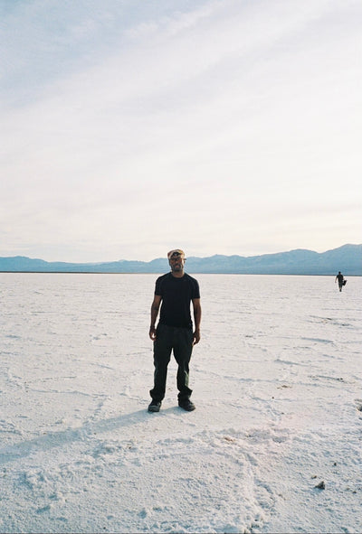
The Bridge to Nowhere, as its called, is a novel destination. The structure itself sits alone, roughly five miles from the terminus of the East Fork Road—the partial, remaining successor of the original road which was wrecked in those ‘38 floods, and to which the bridge was designed to connect—and it enjoys a mysterious, almost mythic reputation among both the locals and visiting hikers. Where the East Fork Road ends, the trail to the bridge begins off to the right of the small parking lot, down the dusty Forest Service road.


Immediately, the dull roar of the San Gabriel River can be heard, rising up from where it rushes through the valley below. Of course, the water level is nothing like it was that fateful day in 1938, but the flat, grey plains that sprawl out around its banks are still prone to regular bouts of more minor flooding. The initial road hugs the mountain wall, and descends easily into the canyon. In short order, it meets Heaton Flats, a small campground and picnic area. From here, the road becomes a proper trail, hugging the river in rocky, sometimes shifty stretches as it climbs deeper into the mountains—and be warned: The price of admission here is wet feet. More than a half dozen times the trail slips back and forth across the stream. Often, the crossing is easily done, with no more than a bit of cold, ankle-deep splashing. But when the water is high, take some serious care—there have been, it’s important to say, a long list of fatalities here. But with basic precautions and suitable weather, there’s little reason for concern.

Winding and rising, weaving and tumbling, disappearing only to reappear again some ten meters away, the trail is notoriously difficult to follow. But thankfully, the general directions are simple enough: stick to the river. At any given point, there are likely three or four distinct paths that might be taken—some as clear as fire roads, others as subtle as game trails—but all leading toward the same end, and never straying far from the rushing water. Likewise, the trail progresses (sometimes sporadically) through different terrains—shady riparian woodland, sparse high desert, rocky riverbed, silty floodplain—never allowing itself to be bored, or be boring.


After a few miles, a quaint wooden bridge appears, spanning a small crevasse. This bridge actually goes somewhere: It’s called John Seales Bridge, and the gap is Lauren’s Gulch. The structure was completed in 2009, using horses, mules, manpower, and helicopters in an endearing display of cooperative public effort. Immediately on the other side, a sign proclaims the beginning of the Sheep Mountain Wilderness, and the ground bears some remnants of the old asphalt road. At this point, you’re just past halfway.

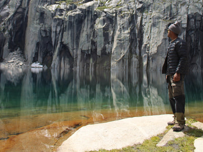
Not long after, the trail disappears for a stretch of some twenty meters into the river. There are two ways to get through here: First, by walking through the water. Second, by utilizing an intriguing, though certainly precarious, rope that’s been strung across the sheer face of the rock on the bank. Do as you will—being alone, and unwilling to risk the embarrassment of some dumb, gung-ho injury, I trudged on through the water.
At this point, the canyon straightens out into a long, grand corridor roughly a mile long. On the right, the old grade of the washed-away road can be seen, a flat line along the canyon wall. Resist the urge to scramble up to it immediately—that time will come, but if done too early, you’ll find yourself led to a dead end, and forced to backtrack to the valley floor. The best trails at this point are those that criss-cross the wide, silty floodplain. But keep an eye to that upper road—after a few minutes, a well-defined footpath (sometimes marked by a rock pile or arrow) will connect to it up a short, steep slope, and it’s best at this point to take it.


This upper path continues parallel to the river as it reaches the end of the canyon, providing some of the most dramatic panoramas yet. Then, as the canyon contracts and swings hard to the right, the river drops away from view. For a few minutes, all is quiet. The trail rises up again among some impressive stony outcrops, then widens and flattens, betraying some of that old graded road again. Then, just as a small, distant roar begins to fill the canyon, a sign appears: “WELCOME TO THE BRIDGE TO NOWHERE” it declares cheerily, “IGNORANCE OR GENERAL STUPIDITY WILL NOT PREVENT ARREST AND PROSECUTION ... YOU ASSUME ALL RISK FOR INJURY OR DEATH UPON ENTERING THIS PROPERTY ... HAVE A GREAT DAY!”


Just a few meters beyond, there it is. At first, the bridge appears rather unassuming: a tan bar across a small gap. But as one approaches, the scale of the whole scene takes on increasing proportions. The gap gapes open into a dizzying ravine, at the bottom of which the river flows more powerfully than before. The bridge itself seems much longer than it did at a distance, and its elegant, spindly legs much more strange and impressive as they extend down, bracing themselves against the sheer, slippery walls. But perhaps what makes the scene so particularly odd (and what gives the whole structure its name) is the complete lack of continuation on the bridge’s far side. The stately stretch of road collides so abruptly with the mountain face that the effect is almost comical, the contrast too sudden and final to compute logically. Of course, the absence of connecting roads is due to a tragic, disastrous event, not a comical one—but if anything, that knowledge only increases the scene’s peculiarity. On that day in 1938, the river below was swollen to a violent torrent that carried whole buildings and overwhelmed dams, and the road on whose bones we’ve been walking was quickly disappearing under the crush of mud, stones, and rushing water. But the bridge, suspended above and between all the action, was undamaged, and hung there as if paused in time, untethered from the raging world around it. The metaphors write themselves. But the practical effect is equally conspicuous. Standing on the bridge, looking down at the now-distant water, I’m surprised to find myself moved by this lonely, useless little artifact of infrastructure. It’s as if two distinct voices are speaking at once: The earth, asserting its dominion; and us, in our wet boots, on a bridge that goes nowhere, asking “So what?”


Leave a comment